

The Environment Agency has submitted a planning application for the Oxford Flood Alleviation Scheme designed to reduce flood risk to homes, businesses and transport links in Oxford.
The major project led by the Environment Agency in partnership with nine other organisations, is one of the biggest flood schemes currently planned in England.
Oxford has a long history of flooding, with significant floods in recent decades damaging homes and businesses and closing the railway and major roads into the city.
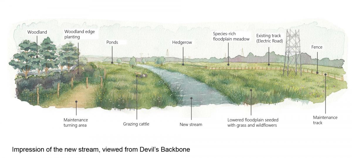
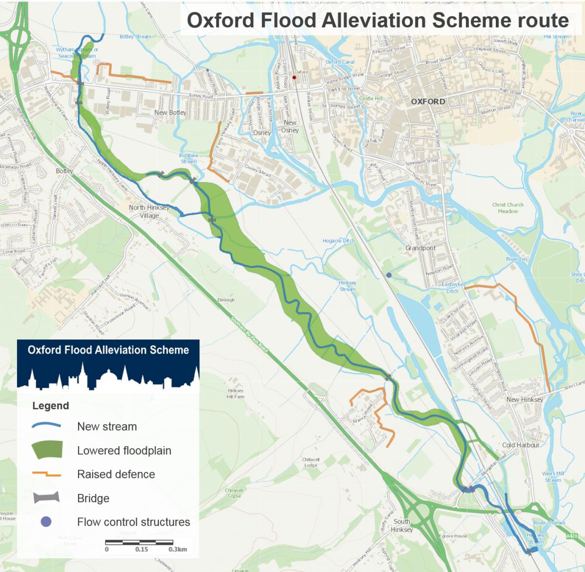
Working with the natural floodplain to the west of Oxford, the proposed scheme will create a new stream, meandering through a gently sloping floodplain of grazing meadow with wildflowers and wetland.
READ ALSO: Oxford house prices increase by 12%
When water levels in the River Thames are high, the stream will start to fill its floodplain, reducing flood risk to built-up areas of the city.
The new stream will be approximately 5km long, running from just north of Botley Road down to south of the A423 near Kennington, where it rejoins the River Thames. Most of this area is farmland and flood meadow.
The scheme will see improved footpaths, and a new permissive walking and cycling path alongside the stream between Osney Mead and the Devil’s Backbone in South Hinksey.
The scheme will create over 20 hectares of new wetland habitat and around 16 hectares of floodplain meadow. It will be maintained largely through traditional land management techniques such as grazing.
Hard engineering will be kept to a minimum, but there will be new structures where needed, such as bridges for footpaths to cross the new stream, culverts (tunnels) for floodwater to pass under main roads and earth embankments and flood walls.
Joanne Emberson Wines, flood risk manager at the Environment Agency, said: “It’s a long-term solution that will help the city adapt to our changing climate and make it more resilient to future floods.
READ ALSO: The Oxfordshire properties issued with closure orders
“The scheme has also been designed to bring environmental and community improvements to the area, creating a new wetland landscape that will benefit wildlife and local people for generations to come.
"Submitting this planning application is a huge step in making this a reality for communities in and around Oxford.”
The scheme is projected to cost £150 million to build, and will save £1.4 billion in avoided damages, by reducing flood damage and impacts on the city over the next 100 years.
Councillor Emily Smith, leader of Vale of White Horse District Council, said: “With climate change, flood risk is increasing, and therefore the need to protect our communities has never been more pressing.
"The Oxford Flood Alleviation Scheme will provide much needed reassurance to the Vale communities of South Hinksey, Kennington and North Hinksey, which are at regular risk of flooding.”
The Oxford Flood Alliance, made up of local residents affected by flooding, has worked closely with the Environment Agency over many years on its development.
A representative said: “We’re proud to have helped get the scheme to this point - it has been a huge effort across multiple partners bringing their expertise to the table.
“Risk of severe flooding is increasing all the time and we need to ensure we are in a position to manage this.”
Oxfordshire County Council will decide whether to approve the application following their online public consultation.
People can submit comments on the planning application via the council’s ePlanning system at https://myeplanning.oxfordshire.gov.uk/Planning/Display/MW.0027/22.


Comments: Our rules
We want our comments to be a lively and valuable part of our community - a place where readers can debate and engage with the most important local issues. The ability to comment on our stories is a privilege, not a right, however, and that privilege may be withdrawn if it is abused or misused.
Please report any comments that break our rules.
Read the rules here