


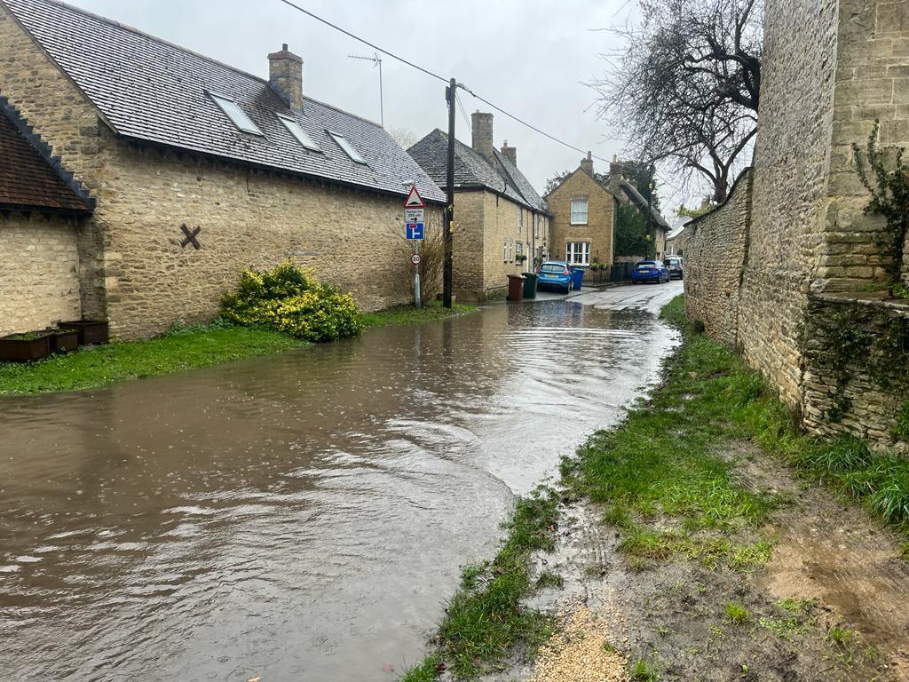


Concerns have been raised over severe flooding in an Oxfordshire village after emergency road closures are put in place.
Residents say rainfall in recent days has seen the worst flooding in Islip since 2019 as many parts of the county remain under alert.
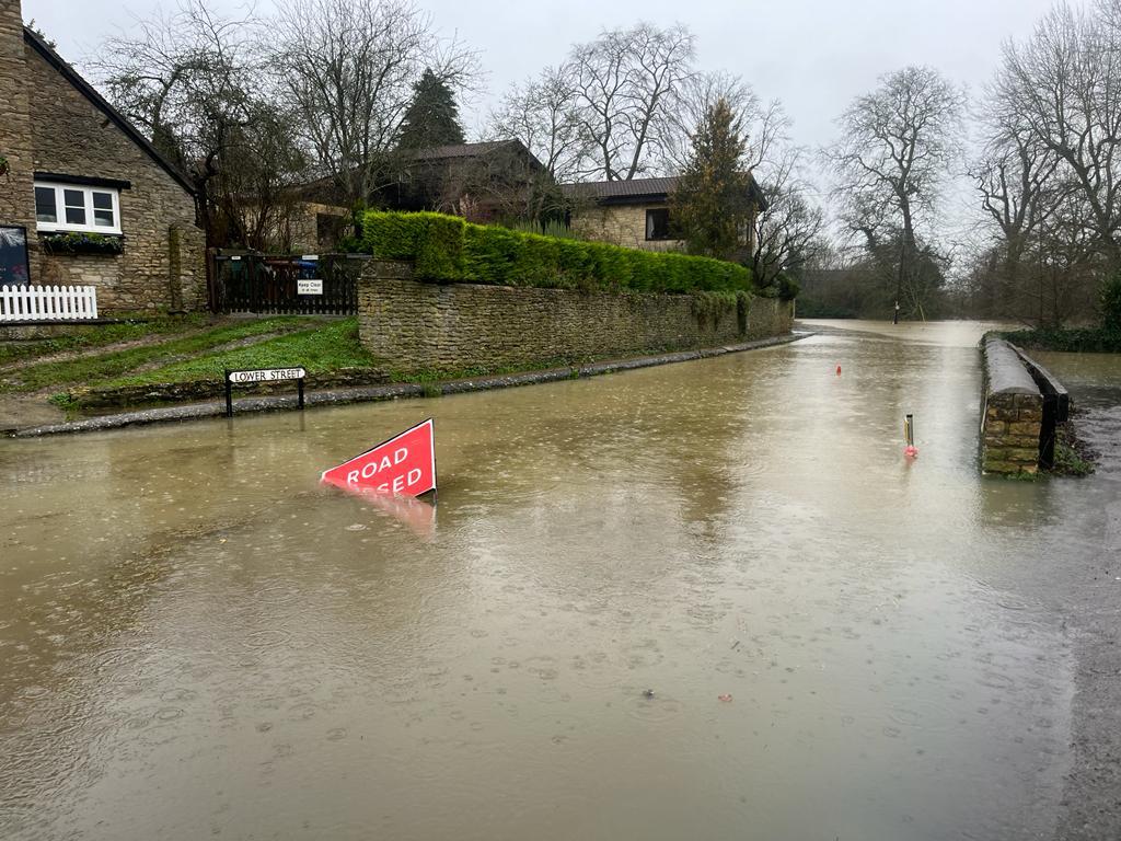
The River Ray has spilled onto Lower Street which has been closed to drivers as residents are forced to place closure signs on either end of the road.
READ MORE: Property flooding expected as road closures in place

Mill Street, which has a specific traffic management plan, remained open this morning (January 2) but Oxfordshire County Council has confirmed it has since been closed to through traffic.
Temporary traffic lights are in place as traffic is confined to a two-way flow using two Kings Head Lane, which is normally a one-way street.
Additional sandbags have also been deployed to assist the residents of Mill Street in protecting their properties.
Paul James, 70, who has lived on Lower Street for five years said: “It does seem to becoming more frequent. We have three or four floods a year and they can last from anywhere from one week to three weeks making this road impassable.
“We are a bit concerned that nobody from the council is taking it seriously enough to give instructions on what we are supposed to do about it.
READ MORE: Top British eventing rider avoids jail after fire risks at Oxfordshire yard

“There are some very old and now damaged signs which the neighbours take in turn to put up until the next van or 4x4 mows them down thinking they can get through the flood.
"It is a worry [water could reach the doors]. It has come up to our kerb and in our particular case we have another few inches spare but is worrying as it's happening so much more regularly now
Emma Wilkinson, 60, said: “We have definitely had a couple of cars stuck so I think better road signage would help all of us and clearer information on how flooded it needs to be before it's dangerous for cars to go through.”
The Environment Agency said peak levels are expected to be lower than the flooding in November 2019.

Alison Butler, 58, who lives on the corner of Mill Street, said: “We get the flood warnings but it didn’t come until 7.30am, we could have done with it last night really and we have to hope it doesn’t get too much deeper.
“The worry is as soon as a car breaks down, then the road is blocked and there is no management.
“You have got traffic coming down Kings Head Lane and across the bridge and there is nowhere from the traffic from the bridge to go up through the village and they are stuck so you get gridlock.
“We can’t put a road closed sign out like Lower Street as there isn’t another way around.
“You don’t have to set up a diversion but here there is nothing we can do until the authorities decide it’s time to shut the road. We just have to wait, sit it out and hope for the best.
An Oxfordshire County Council spokesman said: “Islip is one of several locations where signs have been provided locally to deploy when required.
“In most cases, the parish councils let us know when signage is erected so the correct paperwork for road closures can be prepared. We are also informed when the roads are clear of water again.
“These signs are currently deployed in Lower Street, which regularly floods.”

The weather is expected to stay unsettled throughout the week across the UK but there are signs it could calm down after the weekend, the Met Office said.
Chief meteorologist Paul Gundersen said: “Our latest analysis of the forecast shows an increase in the likelihood of very strong wind gusts across parts of southern Wales and England, which is why we have issued this amber warning this morning and named Storm Henk.
“Storm Henk will initially bring very strong winds to the South West of England and southern Wales, with gusts of up to 80mph possible.
“As Storm Henk moves north-eastwards across the south of the UK through Tuesday, the strongest winds will also move eastwards, across the south Midlands, Home Counties and East Anglia through the afternoon and evening.”


Comments: Our rules
We want our comments to be a lively and valuable part of our community - a place where readers can debate and engage with the most important local issues. The ability to comment on our stories is a privilege, not a right, however, and that privilege may be withdrawn if it is abused or misused.
Please report any comments that break our rules.
Read the rules hereLast Updated:
Report this comment Cancel