


THE forecast has changed again to suggest Oxford could wake up to snow on Friday morning.
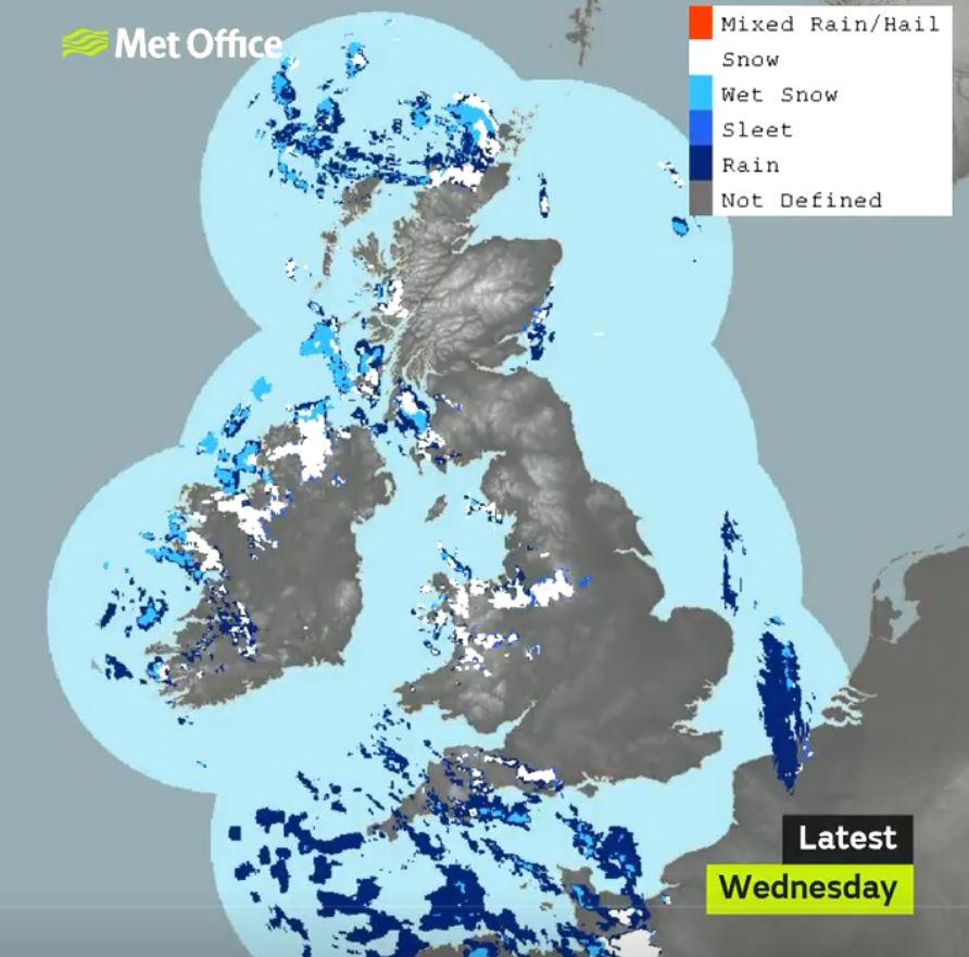
The Met Office now says there is a 90 per cent chance of heavy snow in the early hours of Friday, with 'feels like' temperatures as low as -6 tomorrow morning and the potential for freezing fog.
Lighter snow flurries are expected to start from about 8pm tomorrow evening, although forecasts are ever-changing.
The Oxfordshire Weather Watch Facebook page, which posts about the county's forecasts, posted earlier today: "We really do have a great snow chance [on] Thursday night. Could bring us a couple of cm."
A yellow warning for ice and fog will be in place from 10pm tonight until 11am tomorrow, and another yellow warning for snow and ice will be enforced from 1pm tomorrow until late on Friday.
READ - Which roads in Oxfordshire will be gritted tonight?
Good morning, here is today's's weather summary. Don't forget, you can visit our website (https://t.co/cQSfu1VDbo) for all local & national weather forecasts including the 6-30 day UK outlook. ^Dan pic.twitter.com/HS1HNSXpMw
— Met Office (@metoffice) January 30, 2019
The regional forecast reads: "A very cold and clear night is in prospect (tonight) with a widespread hard frost. Some freezing fog is likely to develop, especially later in the night, and locally becoming dense. Minimum temperature -5 °C.
"Early freezing fog Thursday morning with some brightness. Cloud soon increasing with strong winds, rain and snow arriving by afternoon, occasionally heavy giving risk of disruption. Coastal gales possible. Maximum temperature 4 °C."

Heavy snow was being predicted earlier in the week but those hoping for a blanket of the white stuff were left disappointed.
- When will it start snowing near you?
- Snow in Oxfordshire as temperatures plunge
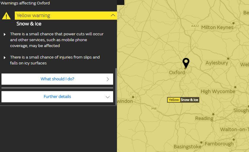
The yellow warning, which covers all of Oxfordshire and much of the country, cautions pedestrians, road users and rail and air passengers about icy surfaces.

It adds: "There is a slight chance that some rural communities could become cut off... There is a small chance that power cuts will occur and other services, such as mobile phone coverage, may be affected."
#Snow and #ice warnings remain in force across much of the UK this morning - stay #weatheraware https://t.co/QwDLMfRBfs pic.twitter.com/VJntKB3f7G
— Met Office (@metoffice) January 30, 2019
There was snow across the county last week, but it did not settle for long.


Comments: Our rules
We want our comments to be a lively and valuable part of our community - a place where readers can debate and engage with the most important local issues. The ability to comment on our stories is a privilege, not a right, however, and that privilege may be withdrawn if it is abused or misused.
Please report any comments that break our rules.
Read the rules hereLast Updated:
Report this comment Cancel