
TODAY the Oxford Mail can demonstrate the difference in height Oxford City Council officers considered crucial for backing the controversial Castle Mill student accomodation.
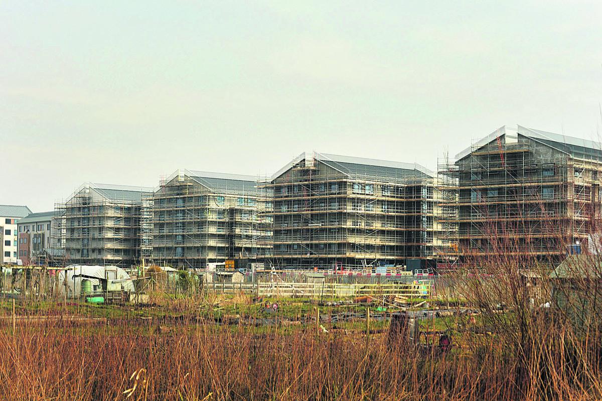
The University of Oxford had originally proposed having the tallest buildings on the development stand at 18.36m.
But that drew a warning from Nick Worlledge – the leader of the city council’s heritage team – in an internal heritage advice document that they would harm Oxford’s “fragile” skyline and erode the heritage views from Port Meadow.
Within days a revised application was sent to the council, lowering the tallest buildings to 17.16m and offering to pay for landscaping along Castle Mill Stream.
It won planning permission from west area planning councillors – who were not shown Mr Worlledge’s concerns on the original proposal – and on Friday Michael Crofton Briggs, the head of city development, said the application had been submitted to “address the concerns raised”.
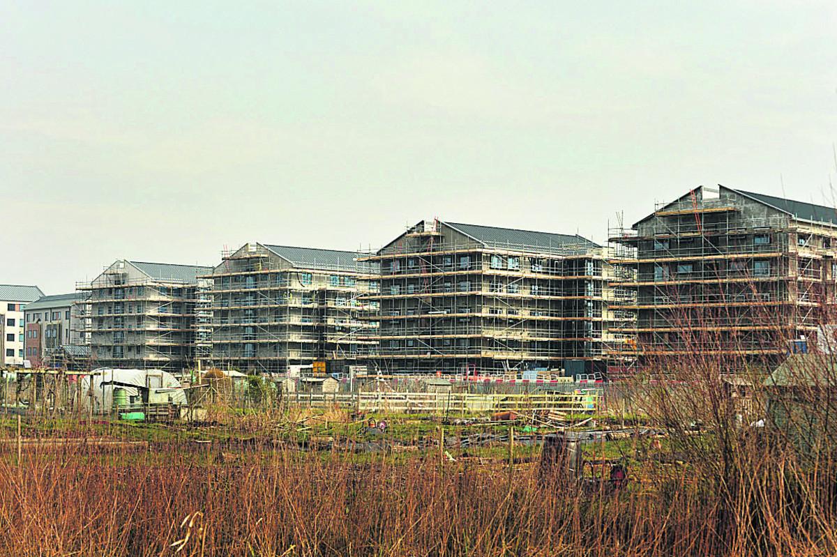
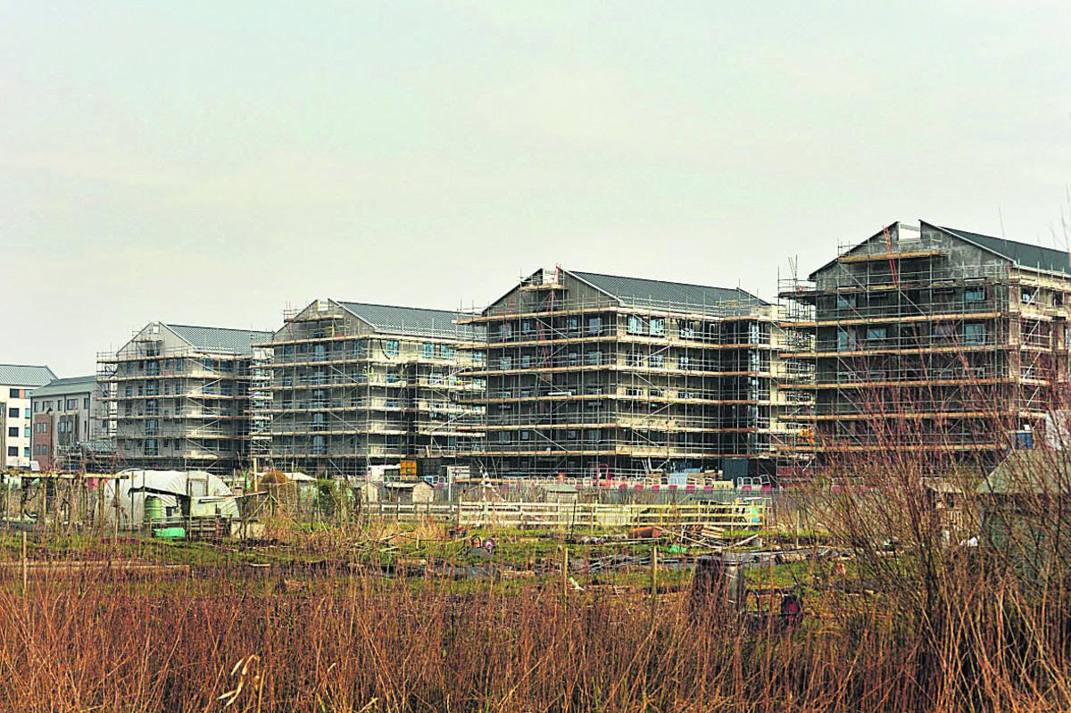
After Mr Worlledge’s report became public, the Oxford Mail created the images attached to this story as a comparison between the two heights – the difference of which is the equivalent of the size of an average four-year-old boy, according to the World Health Organisation. The first image is a composite of the two, with the 'shadow' showing the relative difference. The second image is the building as it is and the third an estimation by the Oxford Mail of what it would look like at 18.36m.
Last night protesters against the development said the images showed there was no crucial difference.
Jericho resident Toby Porter, who has been leading the campaign to have the buildings lowered by two-storeys, said: “Of course 1.2m doesn’t make a difference.
“The city needs the planning department to be flagging these issues up and councillors need to be treated with the maturity to let them know there were significant objections.”
The Oxford Mail asked the city council to be able to interview Mr Worlledge over whether the 1.2m in height would have altered his opinion but this was refused.
Instead we were sent a statement from Mr Crofton Briggs, left, who said: “With all planning applications the city development team assess each application on its individual merit.
“Comments from across the team are fed into the report from myself which is then submitted to councillors for their comments.
“The original comments from the heritage and specialist services team leader relate to the proposals for Roger Dudman Way as originally submitted. These plans were revised and were then re-submitted to address the concerns raised.
“The officer report that went to west area planning committee on February 15, 2012, is available to view on the website and contains the heritage significance of the Port Meadow view.”
The report to the committee said: “...the University has sought to mitigate the impact of its development by lowering the overall height of the accommodation blocks by 1.2m from that original submitted in the planning application and offering to fund landscaping along the Castle Mill Stream where gaps in the tree and hedge belt currently exist.”
Protests against the height of the Castle Mill development – which will have 312 postgraduate units – only really began after building started.
Sushila Dhall, below right, another campaigner for lowering the buildings, said after she was shown the images: “Is this a trick question?
“I can’t see any difference between them, and so no I do not think the ‘difference’ between them is enough to give the ‘shorter’ one planning permission.”
City councillor Elise Benjamin, who sat on the planning committee but abstained from voting, said: “I don’t think it does make a difference but it would have been nice to know there had been this 1.2m reduction.
“The committee should have been told about this report.”
But Colin Cook, another committee member who is also the executive member for city development, said: “(Mr Worlledge’s) report was done as a desk study before the officer had been out on a site visit and had a meeting with the applicants and other colleagues.”
- The full report documents are attached below each extract section
Extracts from the Worlledge report
- There are views from various parts of the common, as well as from the Thames towpath, enabling a dynamic viewing experience.
- Only the tops of buildings are visible as delicate spikes, spread evenly across the horizon.
- The expansiveness of the view means that the spires, towers and domes appear relatively small and could be easily dominated or obscured, compromising their pre-eminence.
- Photomontages show that from some parts of the meadow the view of the
- St Barnabas campanile will be obscured with the long unrelieved roof line cutting across in front of it.
- The assessment of the view explains that the skyline is fragile and its significance harmed by new buildings that would compete by virtue of their scale and form or by obscuring views if their height breaks through the layers of greenery within the view.
- There is no justification for this harm... Additional landscaping, if it was possible to achieve, is unlikely to be sufficient mitigation – simply hiding an object in a view may temporarily help to reduce a visual or aesthetic impact, but it does not resolve the conflict with the site’s evidential, architectural and historic values.
Nick Worlledges heritage advice Jan 12.pdf
Extracts from the West Area Planning Committee report
- Land at Port Meadow is more sensitive. Indeed the very northern tip of the application application falls just within the “View Cone” from Wolvercote where policy HE 10 of the adopted Local Plan seeks to retain significant views and protect the green backcloth to the city from development within or close to a view cone which might distract from them.
- The view across Port Meadow is a low lying, distant and expansive one across the floodplain of the River Thames towards the centre of Oxford.
- The line of trees along the railway line and a variety of more ornamental trees in the gardens of North Oxford reinforce this green setting, from which the “dreaming spires” emerge, seen against the open skyline.
- In relation to the current application the pre-eminent spires on the skyline from Port Meadow are not impacted to any great degree by the current proposals as they are located to the east.
- Indeed the university has sought to mitigate the impact of its development by lowering the overall height of the accommodation blocks by 1.2m from that originally submitted in the planning application and offering to fund landscaping along the Castle Mill Stream where gaps in the tree and hedge belt currently exist.
- Certainly it is not the case that the development would be entirely hidden from view from Port Meadow or that there would be no impact from the development on the landscape and on public views. Rather, officers have come to a conclusion, on balance, that with the mitigation described in place then in similar fashion to the extant permission the impact is not such that taken in context with the benefits of the development in providing much-needed purpose-built student accommodation at an allocated site that planning permission should be denied.


Comments: Our rules
We want our comments to be a lively and valuable part of our community - a place where readers can debate and engage with the most important local issues. The ability to comment on our stories is a privilege, not a right, however, and that privilege may be withdrawn if it is abused or misused.
Please report any comments that break our rules.
Read the rules hereLast Updated:
Report this comment Cancel